<<< back
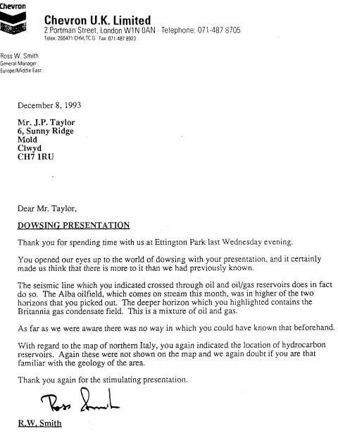
In 1993 Peter showed Chevron
how dowsing could be used to locate gas and oil fields using map
dowsing.
 |
Chevron's
fact sheet shows
that my dowsing results were correct; there has proven to be a
large oil field called Alba within the massive oil and gas field at
Britannia.
Click here to see Chevron Oil fact
sheet. |
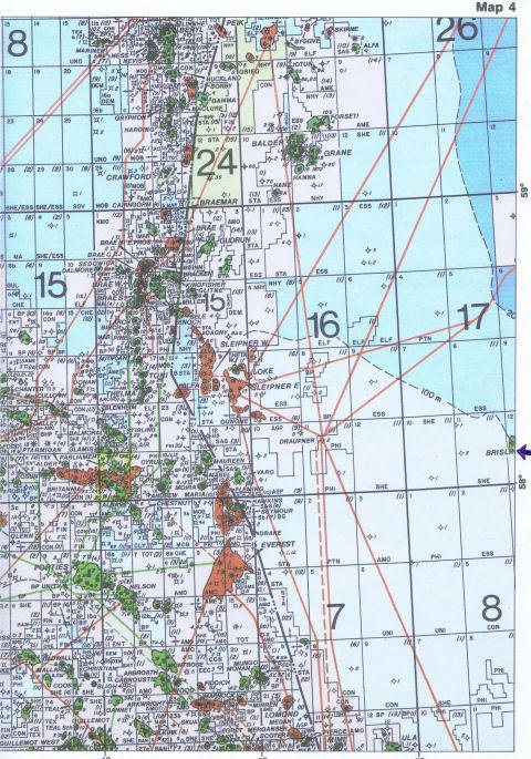
Map location below showing the
Britannia oil and gas field and the Alba oilfield highlighted in
yellow.
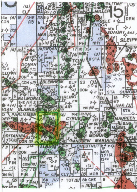
The Britannia oil field is
marked on the above map in rust colour stretching east west from
Parliament to Cyrus.
To give some perspective this
is the zoomed out version of the map. |